I haven’t done a focus on the standards since before Thanksgiving, the holidays have a way of distracting me! I thought that we could pick up where we left off – so here are some activities for another social studies standard.
Remember, the Standards that I use every day, and am most comfortable with are Ohio’s Early Learning Development Standards – you can review them here, however I’ve found that even if your State’s standards differ, many of these activities can still be aligned similarly. I’ve rounded up some great ideas today!
Domain: Social Studies
Strand: Geography
Topic: Spatial Thinking and Skills
This standard specifically relates to maps, and the understanding the our world can be represented on a piece of paper. While young children have a difficult time understanding the entire world, and just how big it is, they are very capable of mapping smaller, more familiar places such as their own bedrooms, or their route home from school. Here are some great spatial activities, I’ve used many of these in my own classroom.
Mr. Printables has a great printable US Map puzzle. The states are cut out in regions so that the puzzle can be put together by focusing on the outline of each region, which means preschoolers can do this successfully, even if they are not familiar with their states.
This is my favorite spatial awareness activity of all time, I found it on Teach Mama. It is a great way to give meaning to some of the geography words that we use, while remaining at a level that is appropriate for preschoolers.
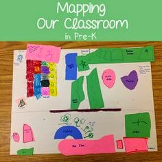
Read about how your students can help you make a map of your classroom over at Prekinders. We did this for our classroom, and then I let the students do their bedrooms at home.
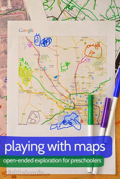
Picklebums suggests printing maps that kids can draw on. This helps them explore all of the different kinds of symbols that can be found on a map. I also like to print a local map and note where each child’s home is, and then locate other places that are important to the children (like McDonalds, the zoo, and Target!).
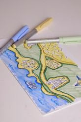
This idea is from education.com, and I love it because it can be customized for each child’s interests – have them draw a fairy tale map (or a superhero map, or a ninja turtle map, or a map of Arendelle, you get the idea). The important part of this activity is sitting down with the children to help them make a list of all of the places that have to be on their map. They know all of these stories like the back of their hand, so they shouldn’t have a hard time listing the places that their character of choice visits throughout the story. Once the list has been made they can draw all of the locations on a map.
These are all great ideas for thinking about spatial awareness in terms of geography, and sure to keep your students engaged and using their creativity!